Live auction - Lot 1062
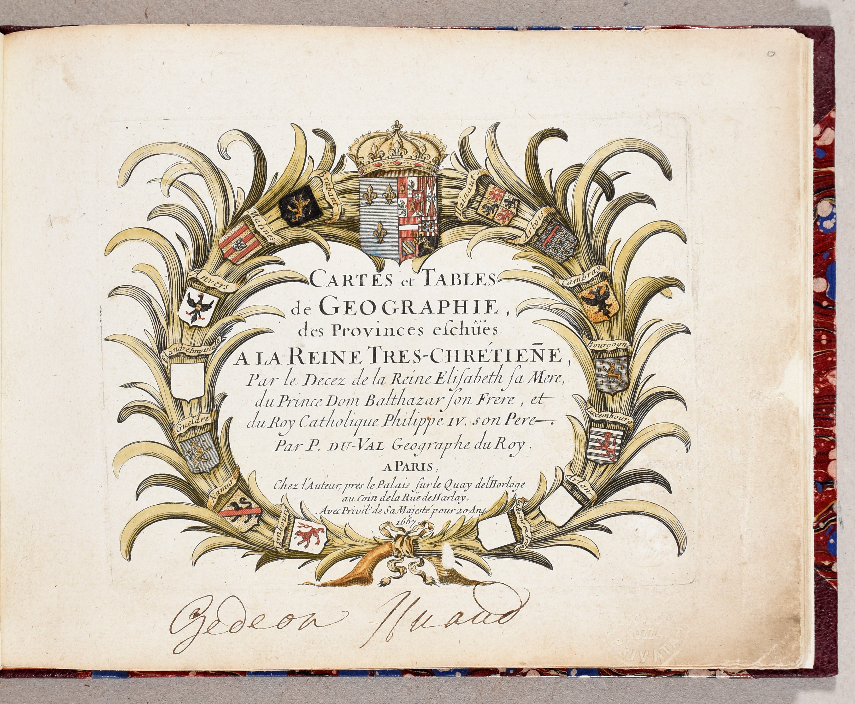
Cartes et tables de géographie des provinces échues à la Reine très-chrétien[n]e par le décès de la Reine Elisabeth sa mère, du Prince Dom Balthazar son frère, et du roi catholique Philippe IV, son père.
Subject: [Atlas - Belgium]
DUVAL, Pierre
€ 800 / 1.000
Live bidding (Drouot*) Live bidding (Invaluable*)Bidding is closed
Lot description
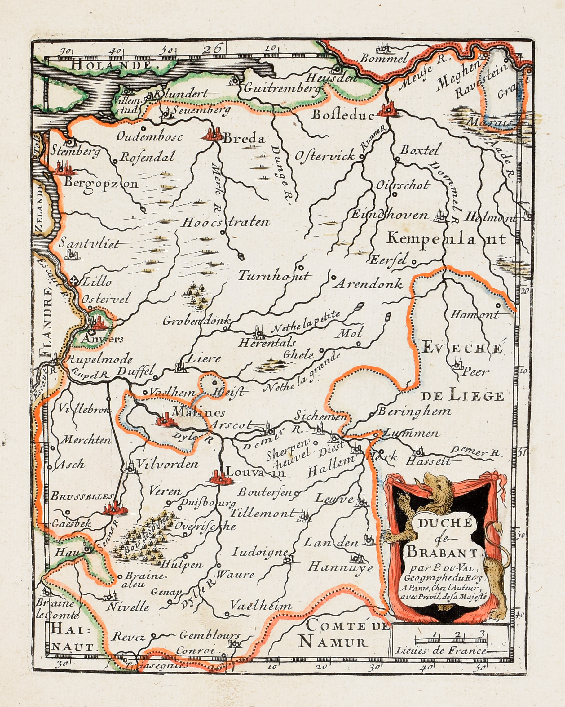
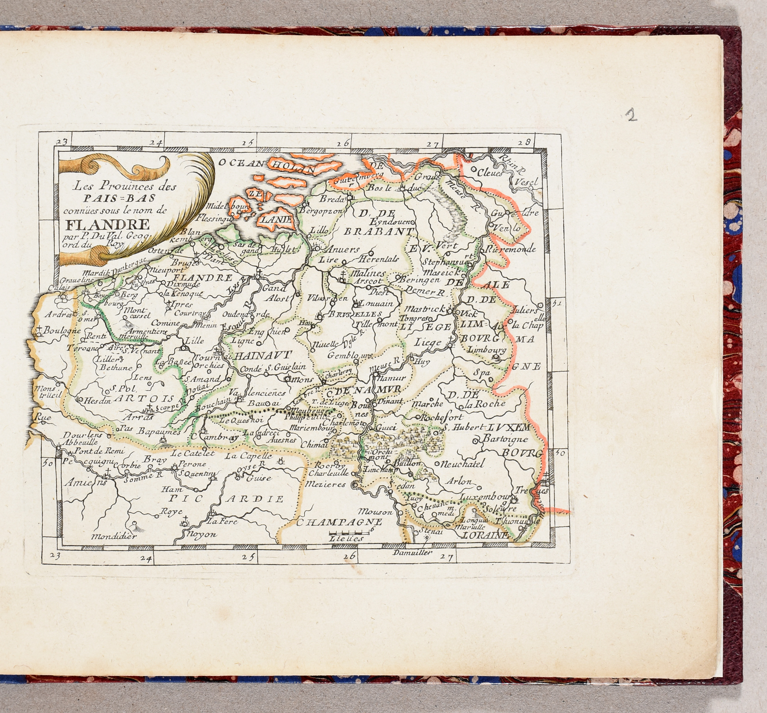
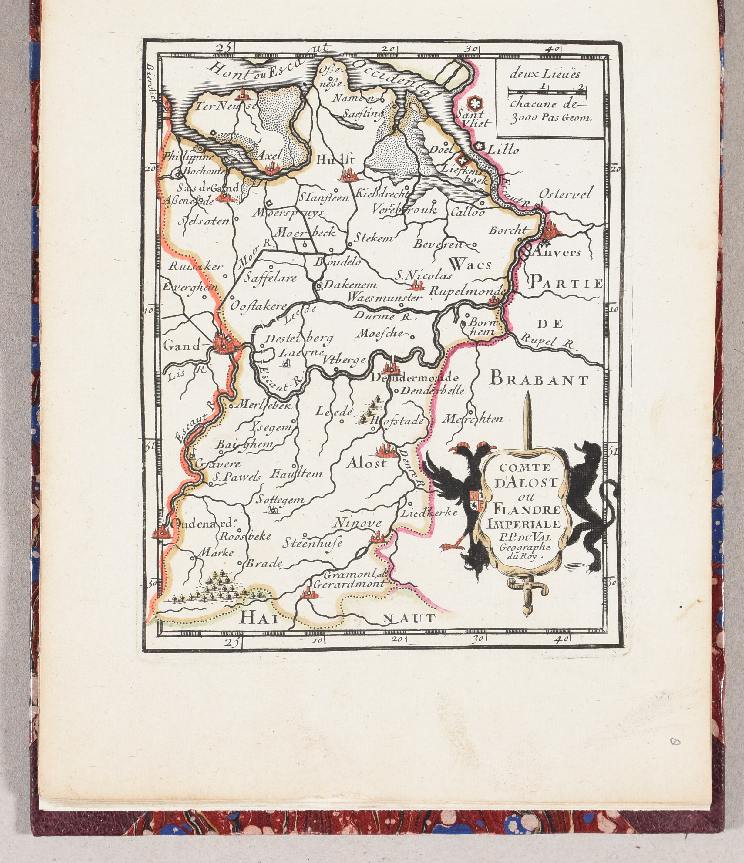
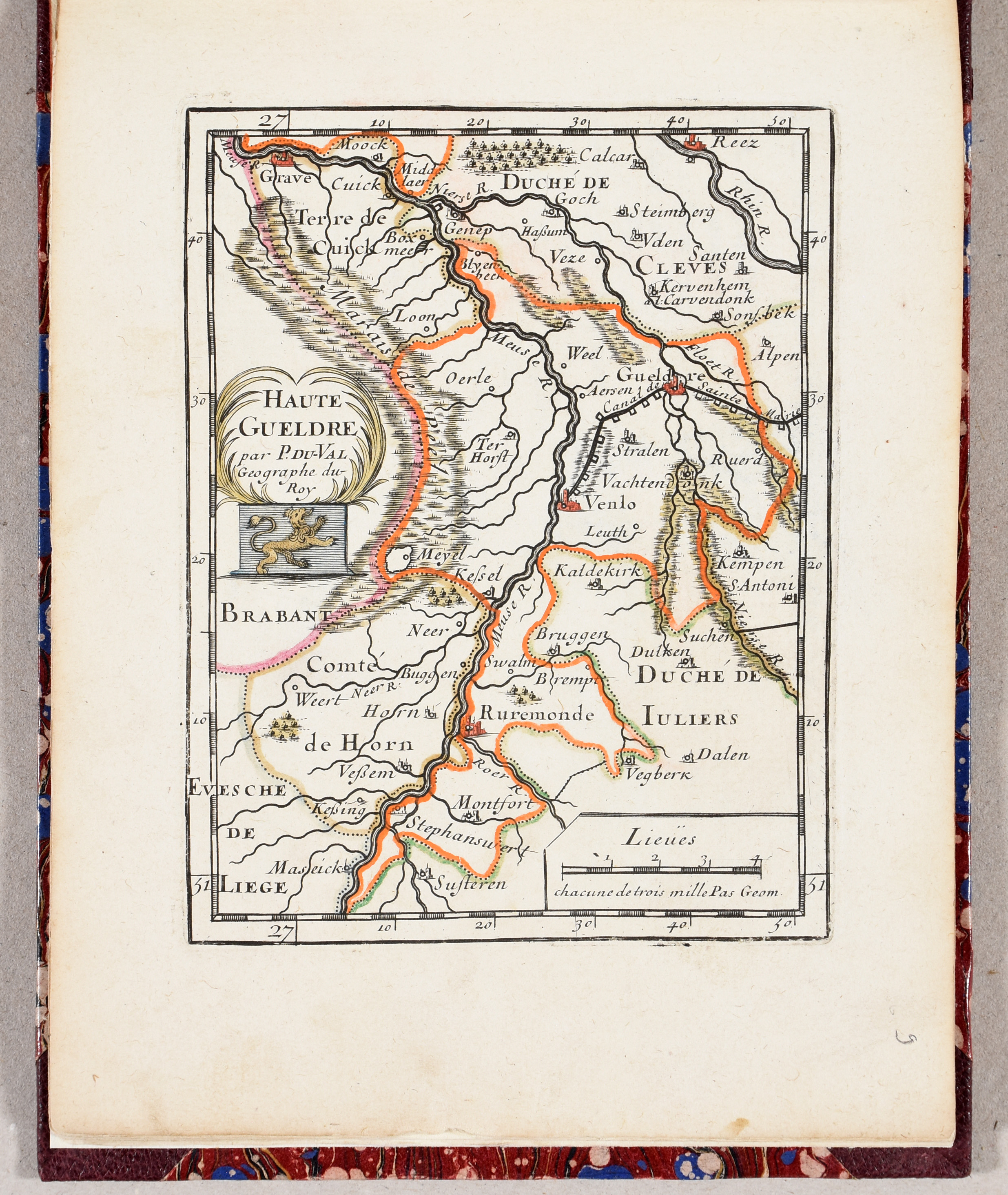
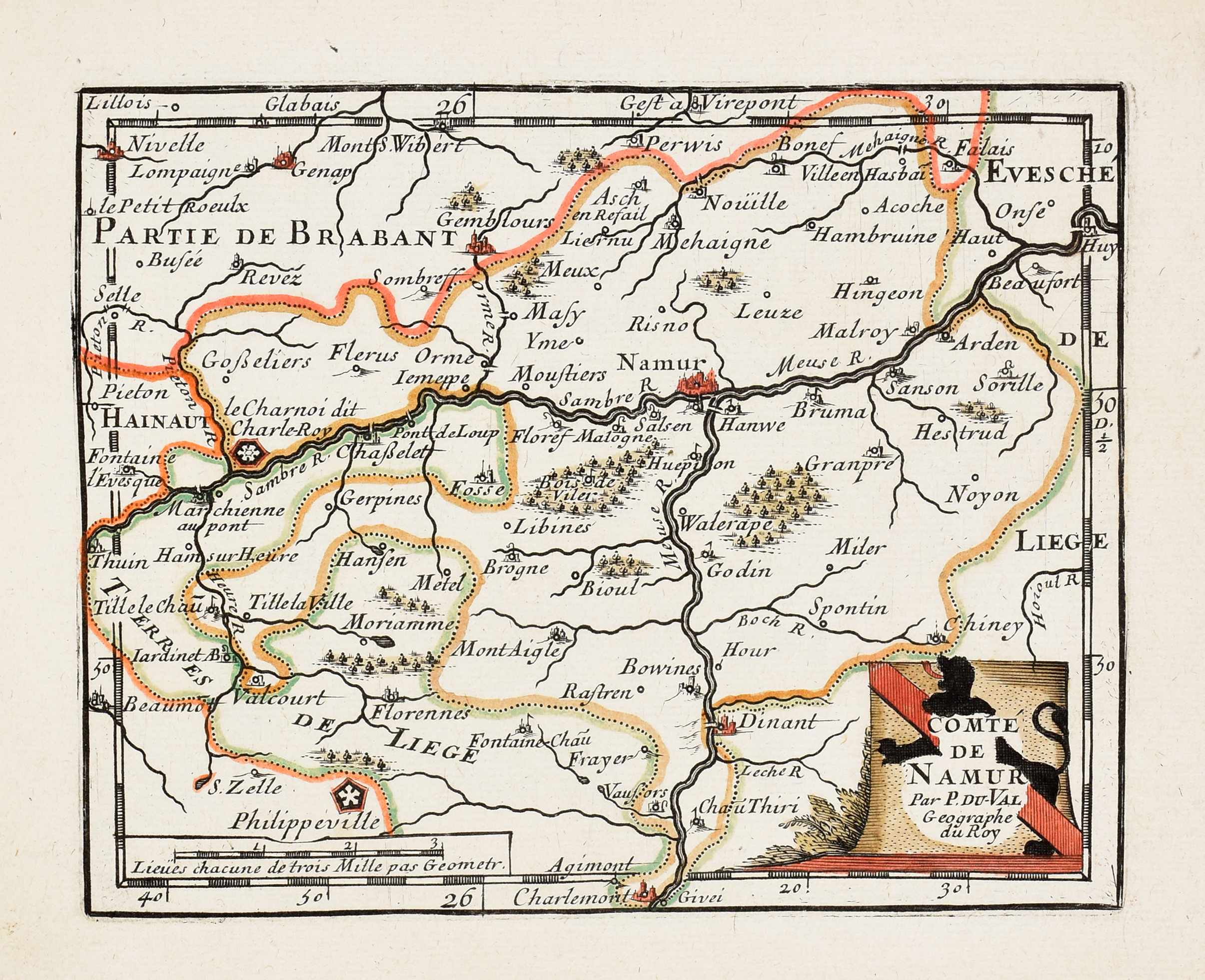
Paris, P. Duval, 1667
Sm. oblong folio (15 x 19 cm): title-9 ff., 14 (of 17) pl., old hand-coloured (sm. defects).
Mod. binding.
Small atlas by the royal cartographer of Louis XIV incl. 9 engr. tables and 14 (of 17) maps of the Spanish Netherlands and Franche-Comté, both then provinces of Spain. Published during the 1667 to 1668 War of Devolution when Louis XIV of France claimed these territories by right of marriage to Maria Theresa of Spain. The 3 missing maps are in fact 2 extra maps on Flanders and Artois and a map of Burgundy. Pastoureau does not mention any tables for the 1667 copy.
Ref. Pastoureau - Duval IVA.
Prov. Gedeon Huard (ms. note). - Edoardo Rozza (coll. stamp).
More photos